Strategic Tools
In New Orleans, the physical city and policy city affect each other in profound ways.
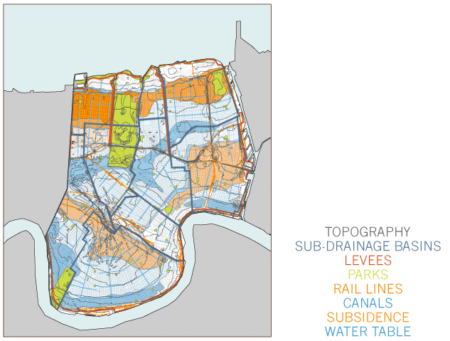
In New Orleans, the physical city and the policy city affect each other in profound ways. Gutter to Gulf has documented existing conditions in both arenas, represented them for multiple audiences, and upheld rigorous standards of documentation to create models that synthesize data about the city’s multiple systems.
Understanding the city’s current circumstances is a complicated project. At the surface, small differences in topography have an enormous impact on drainage; below ground, the high water table affects permeability, and a giant network of pipes carries water to the pumps. Base information about the status quo is unreliable, incomplete, and sometimes inaccessible.
There has been little coordination of information about the physical city—for instance, its soils, its terrain, its infrastructure, its building patterns, and its vegetation—with information about the policy city—for instance, its political subdivisions, its planning districts, its administrative precincts, and its designated neighborhoods. However, considered decisions in either arena cannot be made without knowledge of the other.


